| Drought in the West | A Photographic Essay |
Reno/Truckee Meadows
|
Next → |
Interactive Cartograph: Clickable place names, horizontally scrollable.
Tahoe Meadows: 2.2015
Situated at about 8000' above sea level in the High Sierra Carson Range, Tahoe Meadows is the wetlands headwaters of Ophir Creek.
Peak at 8843' and surrounding meadows with scant snow in early spring. Layers of snow help fill Ophir Creek, Washoe Lake and Steamboat Creek which flows to the Truckee River.
All content, including images © Billy Howard, 2015. —All Rights Reserved— High resolution versions available upon request to witness@diresituation.photos. Larger.
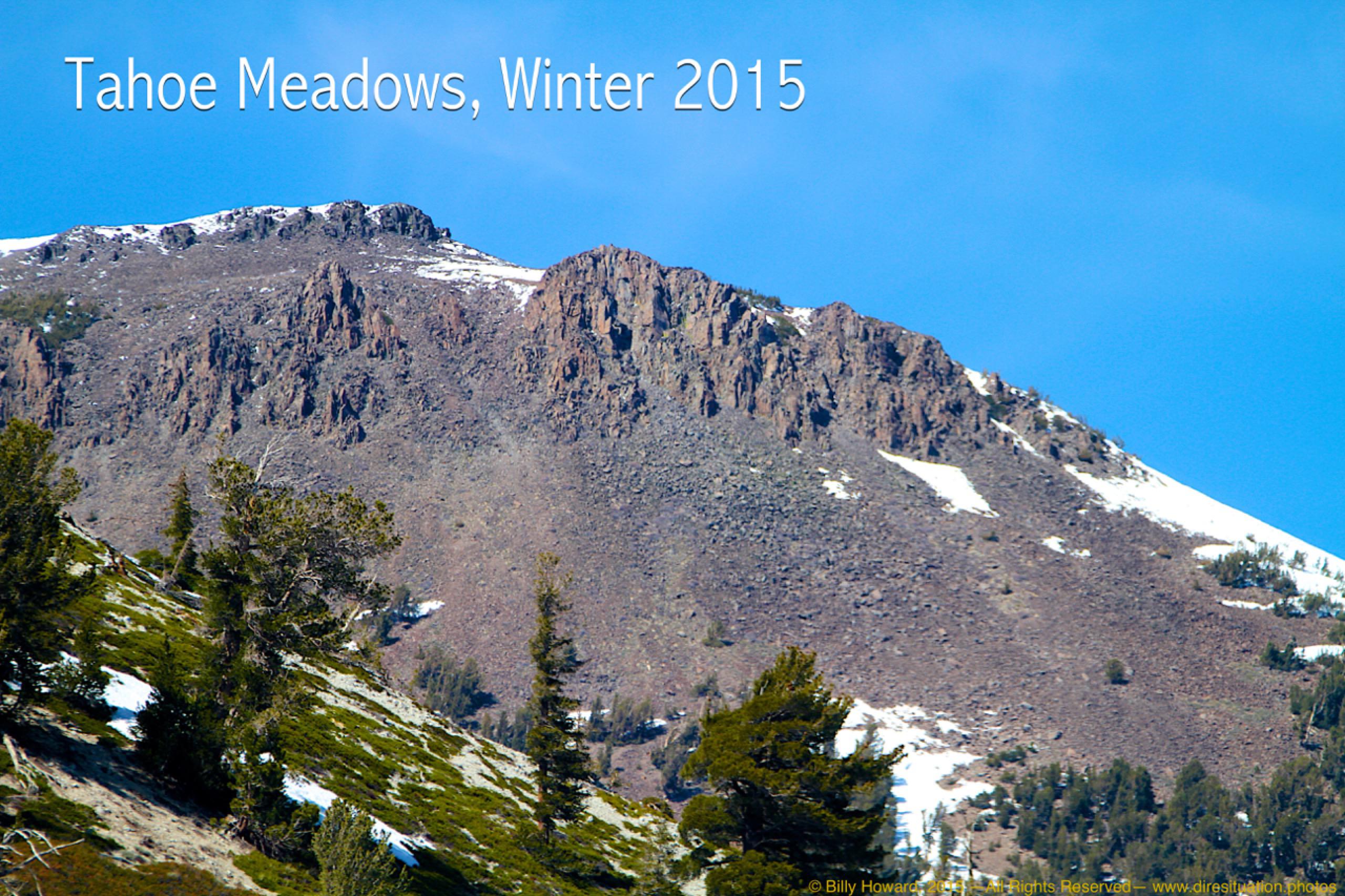
Tamarac Peak above Tahoe Meadows in early spring, 2015.

All content, including images © Billy Howard, 2015. —All Rights Reserved— High resolution versions available upon request to witness@diresituation.photos. Larger.
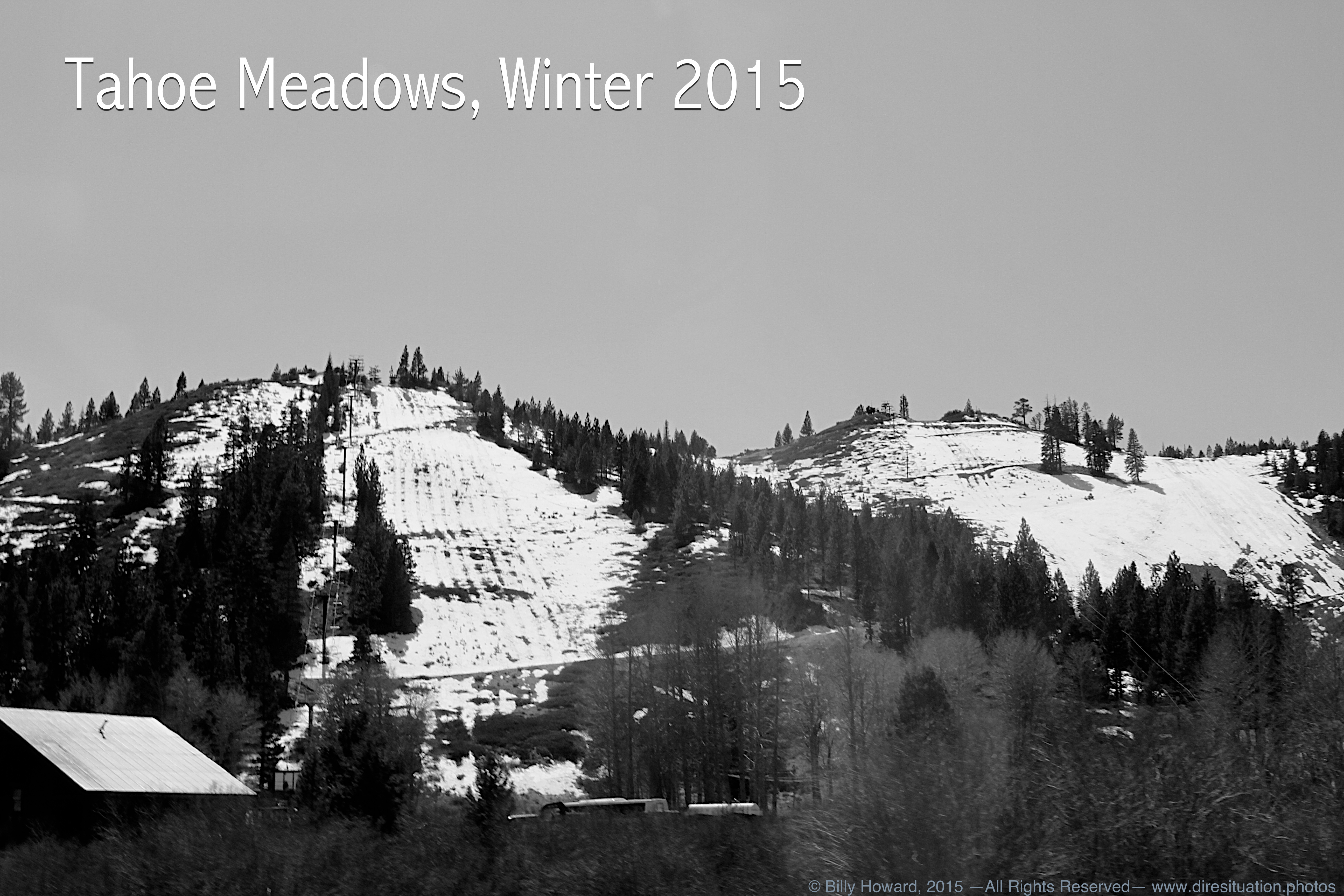
Some ski runs on Slide Mountain's Mt. Rose Ski Resort are bare in early spring, 2015.
All content, including images © Billy Howard, 2015. —All Rights Reserved— High resolution versions available upon request to witness@diresituation.photos. Larger.
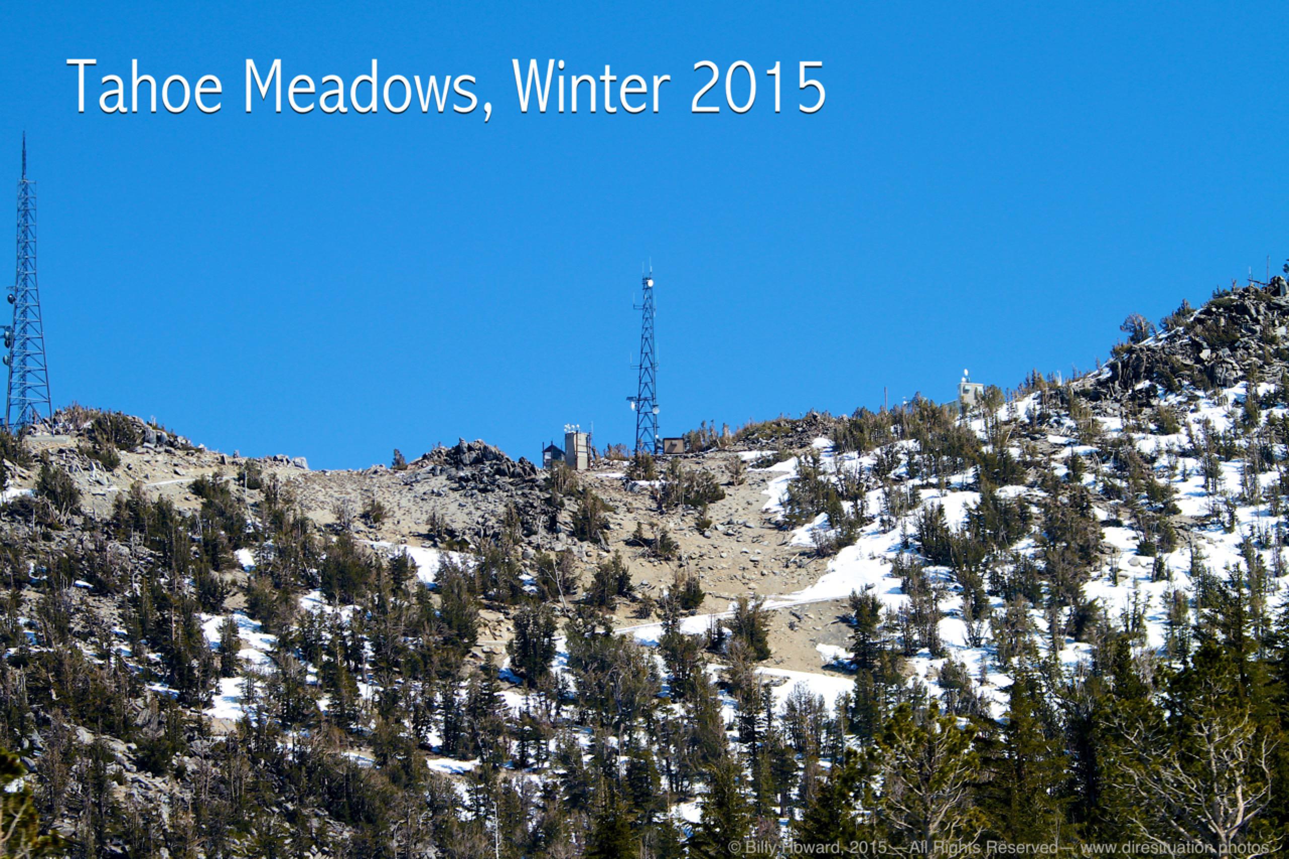
The 9700' summit of the Carson Range's second highest peak, Slide Mountain, bare in spring, 2015.

All content, including images © Billy Howard, 2015. —All Rights Reserved— High resolution versions available upon request to witness@diresituation.photos. Larger.
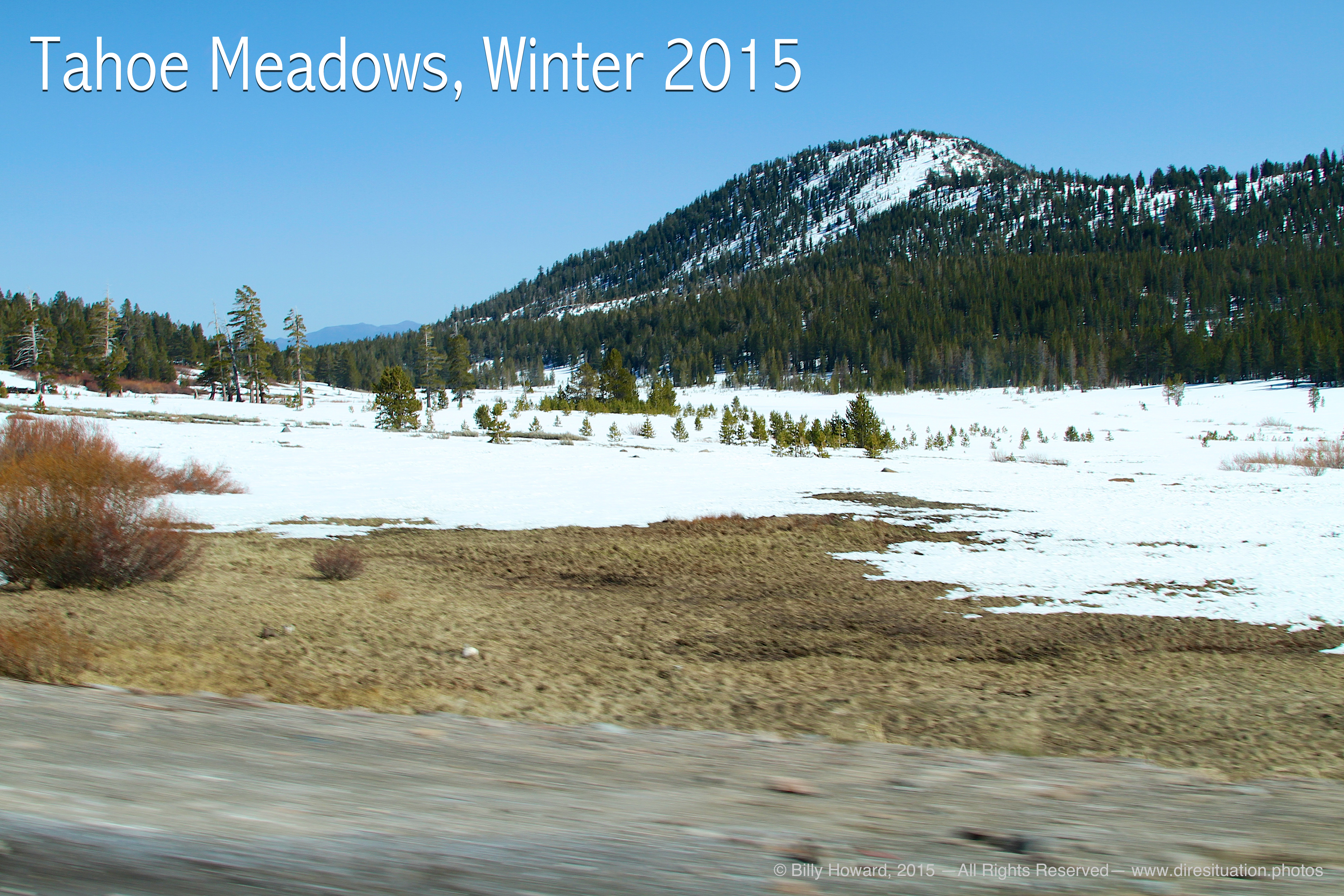
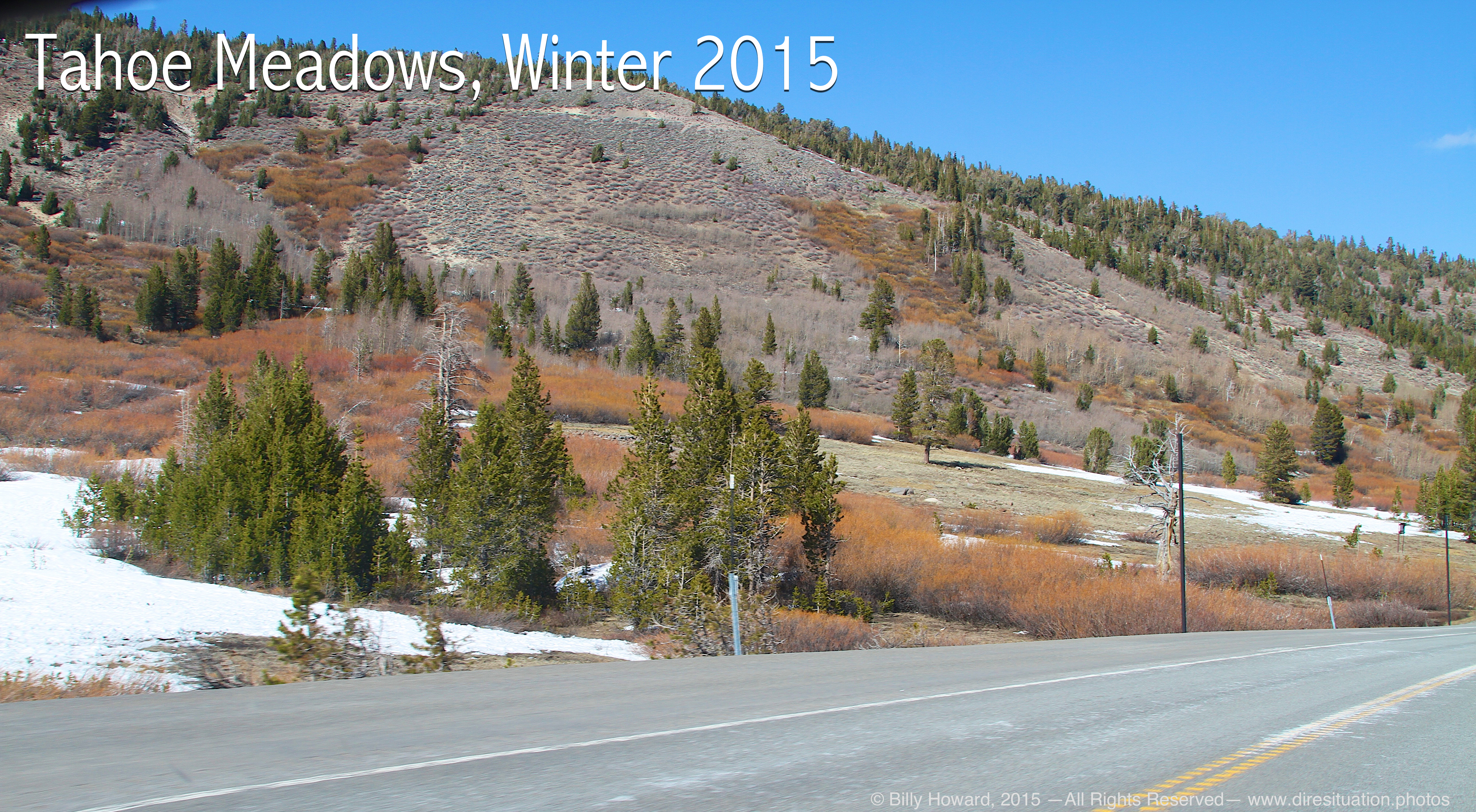
Tahoe Meadows north of Mt. Rose Highway normally gives access to cross country snow recreation all winter and spring long.
All content, including images © Billy Howard, 2015. —All Rights Reserved— High resolution versions available upon request to witness@diresituation.photos. Larger.
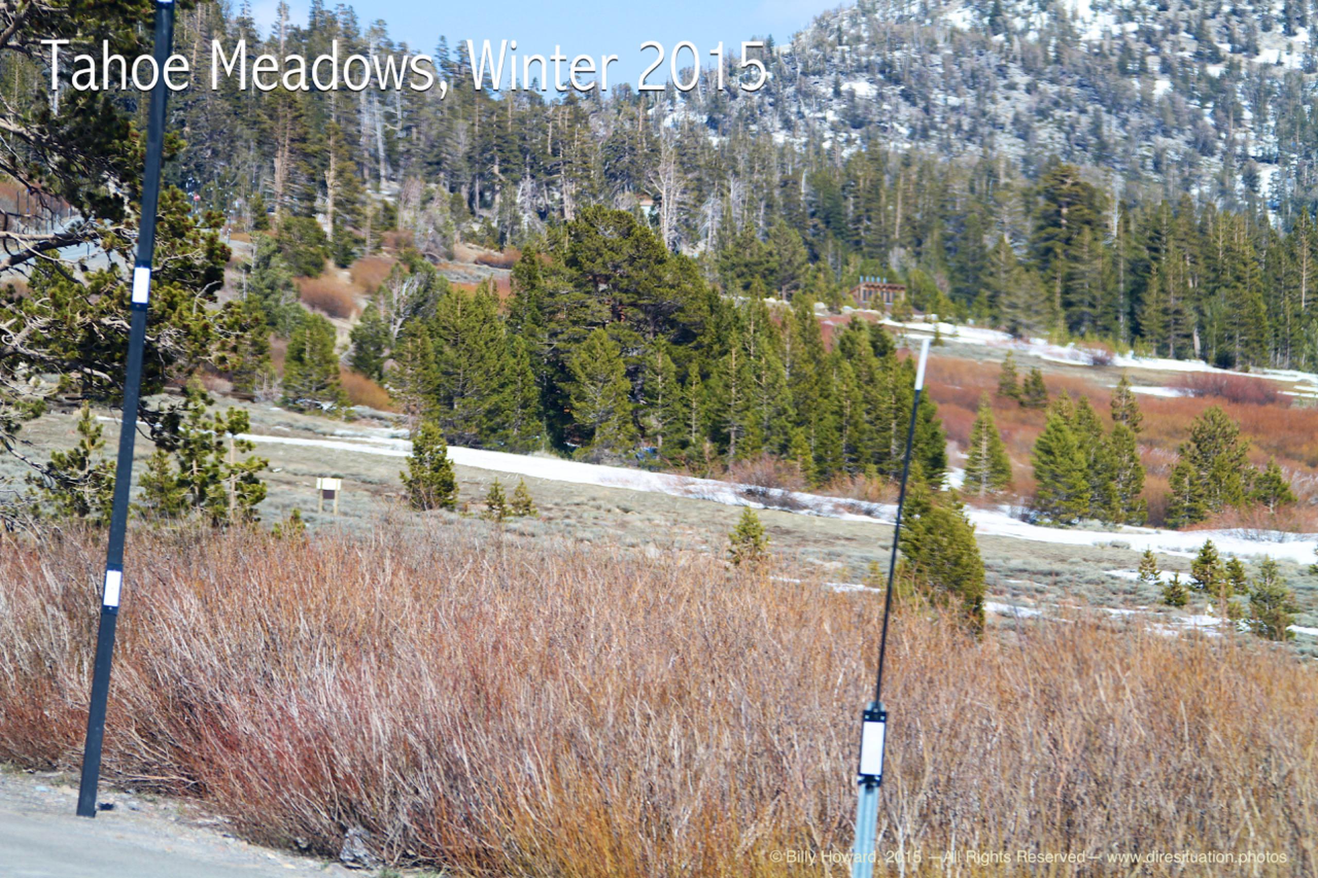
The south side of Mt. Rose Highway in spring, 2015.

All content, including images © Billy Howard, 2015. —All Rights Reserved— High resolution versions available upon request to witness@diresituation.photos. Larger.